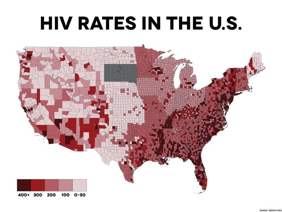
These maps show that some of the nation's poorest regions also have the highest HIV rates.
January 06 2017 7:00 AM EST
July 29 2021 10:08 PM EST
By continuing to use our site, you agree to our Private Policy and Terms of Use.

These maps show that some of the nation's poorest regions also have the highest HIV rates.
According to geographical data, areas of the United States that have the lowest incomes often overlap with areas that have the highest HIV rates.
Some of the poorest regions of America include the Appalachian Mountains, the Deep South, and a section of the Rio Grande Valley (in southern Texas). As Vox pointed out last year, "these regions are joined by scattered sparsely populated, low-income rural counties, often associated with Native American reservations." Here's the map of the U.S. with the poorest counties highlighted in pink.
Meanwhile, as AIDSVu's map (below) indicates, HIV rates are highest in certain big cities (including San Francisco, Los Angeles, and New York) but also in many of the same regions of the U.S. that struggle with poverty — including parts of the Appalachia, the Deep South, and Arizona's Native American tribal lands. The Centers for Disease Control and Prevention believes such poor rural counties, particularly those with high rates of opioid addiction, are the most likely to have an HIV (or hepatitis C) outbreak like the one that hit Indiana in 2015. (See the top 15 states most likely to have such an outbreak here.)

Still, there are other areas, including Florida, where the high rates of HIV don't seem to correspond with lower incomes.
Where does your county fall in all of this?